


Developments in the field of spatio-temporal data are progressing at a rapid pace. Global challenges place new demands on the integration of distributed data and services. The continuously increasing number of sensors, models, and findings from artificial intelligence must be used effectively and sustainably. At the same time, new concepts, architecture models, and terms must be classified correctly and made usable. Artificial intelligence, cloud, digital twins, metaverse, geospatial ecosystem, and data spaces are just some of the aspects that OGC COSI is continuously analyzing and researching. The OGC Collaborative Solutions and Innovation Program (COSI), as OGC’s experimentation lab, capacity development center, and collaborative solutions program, supports standardization and standards application to current issues worldwide.

One challenge is maintaining an overview in this fast-moving, agile IT world around geodata. The OGC COSI has, therefore, defined focus areas, each of which deals with the entire spectrum of spatiotemporal data processing in an exemplary manner. These focus areas provide insights into the respective domains, fundamental approaches, and solutions. The focal points of OGC COSI are
It is OGC’s fundamental belief that maximally effective solutions must be based on open standards and approaches. This is the only way to integrate and process data from different areas effectively. Based on this conviction, the OGC Collaborative Solutions and Innovation Program acts as a standardization driver, a capacity builder for geospatial data processing, and a platform for exchanging experience and knowledge around existing and future systems.
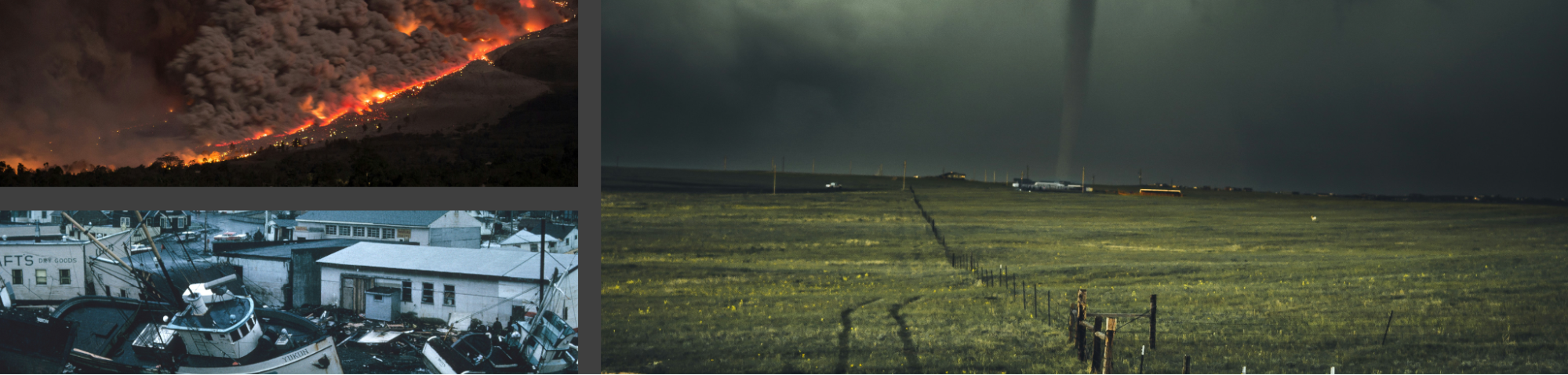
Our climate is evolving rapidly, and with it comes unprecedented uncertainties through more significant and more frequent disasters. With the ever-present threat of rising sea levels, droughts, wildfires, flooding, and more, we must accelerate our readiness for climate change and improve our resiliency to disasters. We must enhance the climate data value chain to create better climate and disaster information for decision-makers.
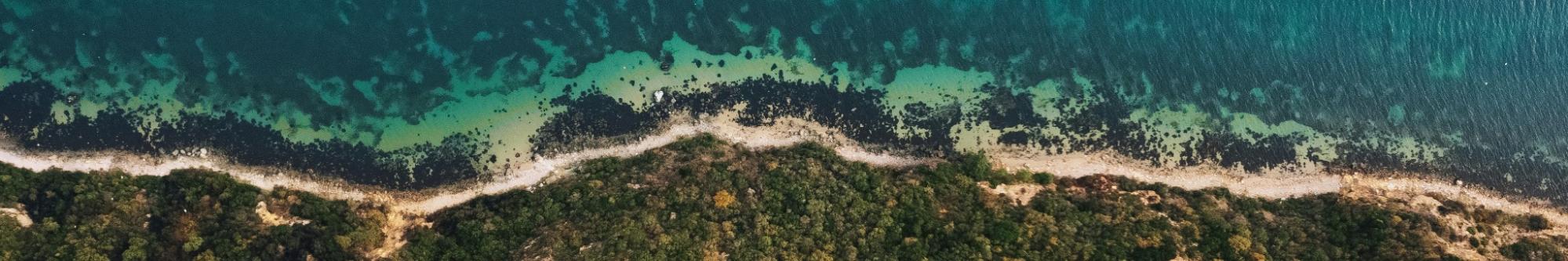
Climate change, marine pollution, and population growth are affecting the world’s coasts, the most critical area of life for billions of people. Habitats are lost, sea levels are rising, and microplastics continue to increase and enter local food chains. One of the biggest challenges of this work is integrating data from the sea with data from the land into a common system – in other words, overcoming the discrepancy between marine and terrestrial data systems and the definition of a digital twin to represent the coastal environment. Such a twin enables those responsible for better evaluating and visualizing the effects on the environment, leading to quicker decisions on protecting coastal areas and their inhabitants.
Standards are intended to offer shared and general solutions to support multiple use cases so that their scope often surpasses the needs of single applications. In particular, standard data models intended to describe domain information through agreed schemata to foster consistent and unambiguous data are usually designed to cover the whole domain and many use cases. Therefore, such comprehensive data models both over-specify and under-specify the information needed to describe a use case’s needs.
The OGC COSI focus, “Standards exploitation through profiles,” uses use cases from geospatial and BIM integration to research the provision and use of profiles of standards as an example. In particular, this involves the definition of building blocks and profiling mechanisms.
While the previous focus examines the maximum benefit of standards within the geospatial and BIM domain, “AI-ready geospatial interoperability” approaches the improvement of interoperability from the technical, domain-independent side. It looks at how building blocks can be defined, the role of knowledge graphs, what the OGC Rainbow is, and why it is essential for high-quality interoperability, all to realize the potential of AI for the areas of Findability, Accessibility, Interoperability, and Reusability (FAIR).

Spatial Data Infrastructures are an established model for exchanging and processing geodata. Despite the name, spatial data infrastructures have never been limited to mere infrastructure services. Early on, they were expanded to include legal, organizational, semantic, social, and other forms of interoperability. However, these aspects were rarely brought to formal maturity, leading to dissatisfaction with the currently available systems. The OGC is investigating new forms and formal models for SDIs as part of the SDI focus. These are now often referred to as geospatial ecosystems, geospatial knowledge infrastructure, or SDI 2.0. Ultimately, however, the question behind all the terms is the same: How can distributed data storage and services be organized as effectively and efficiently as possible in a heterogeneous user landscape, what changes are necessary for existing SDIs, and how can new SDIs be implemented as efficiently as possible based on the experience gained.

At OGC, members collaboratively solve the biggest challenges in geospatial IT, provide consulting services, and develop concepts and technologies that help improve geospatial data handling. This webpage provides all the information you need about the OGC COSI Program.

Receive the latest news on OGC.
© 2024 Open Geospatial Consortium. All Rights Reserved.